Global Water Bodies visualisation script
//VERSION=3

// This custom script visualises water bodies derived from water bodies detection layer (WB )

//set up the input and output settings.
function setup() {
  return {
    input: ["WB", "dataMask"],
    output: {
      bands: 4,
      sampleType: "AUTO"
    }
  }
}

// evaluatePixel function
function evaluatePixel(sample) {
  if (sample.WB == 70) return[0,0,1,1]; // blue
  else return [0,0,0,0] // transparent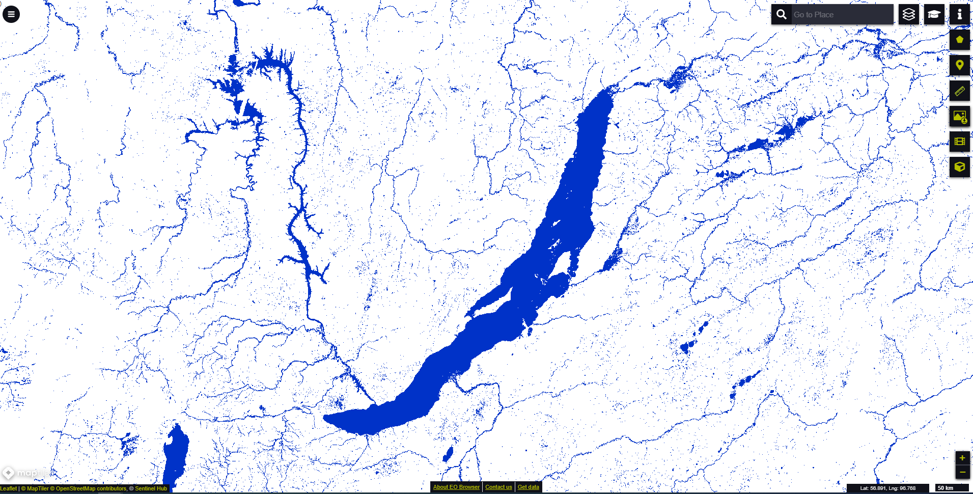
}General description of the script
This script visualizes surface water bodies extent derived from water Bodies detection layer (WB) contained in Water Bodies data.
Table 1: Color legend for the water bodies
| Value | Color | Label |
|---|---|---|
| 70 | Water |
Description of representative images
October 2020 monthly composite map showing surface water bodies extent around Russia’s largest freshawater Baikal lake visualised in EO browser