Pseudo Forest Canopy Density (Pseudo-FCD)
//
// Pseudo Forest Canopy Density (FCD)
// -----------------------------
// 2019 - Antonio Carlon Paredes
// License: CC BY 4.0
// https://creativecommons.org/licenses/by/4.0/
//

// Set to false to avoid detecting water bodies
detect_water = true;

// Colors
let water = [51/255, 128/255, 204/255]; // Blue #3380cc
let hi_forest = [0, 104/255, 55/255]; // Strong green #006837
let low_forest = [62/255, 165/255, 64/255]; // Medium green #3ea540
let grass_land = [186/255, 240/255, 150/255]; // Light green #baf096
let bare_land = [173/255, 136/255, 85/255]; // Brown #ad8855
let other = [0, 0, 0]; // Black #000000

// COEFICIENTS: These coeficients are orientative
// and some tweak may be needed depending on the
// location and case of study

// NDWI water limit
let ndwi_hi = 0.2;

// Bare soil index (BI), soil limit
let bi_hi = 2;

// NDVI high and low limits
let ndvi_lo = 0.20; // 0.20 for L1C (suggested value)
                    // 0.25 for L2A (suggested value)
let ndvi_hi = 0.40; // 0.40 for L1C (suggested value)
                    // 0.45 for L2A (suggested value)

// Shadow index (SI) high and low limits
let si_lo = 0.90; // 0.90 for L1C (suggested value)
                  // 0.92 for L2A (suggested value)
let si_hi = 0.93; // 0.93 for L1C (suggested value)
                  // 0.95 for L2A (suggested value)

if (detect_water) {
	ndwi = (B03 - B08) / (B03 + B08);
	if (ndwi > ndwi_hi)
	  return water;
}

let ndvi = (B08 - B04) / (B08 + B04);
let bi_1 = (B08 + B03 + B04) / (B08 + B03 - B04);
let si = Math.pow((1 - B03) * (1 - B04), 1/2);

if (ndvi > ndvi_hi && bi_1 < bi_hi && si > si_hi)
  return hi_forest;
else if (ndvi_hi > ndvi > ndvi_lo && bi_1 < bi_hi && si_hi > si > si_lo)
  return low_forest;
else if (ndvi > ndvi_lo)
  return grass_land;
else if (ndvi < ndvi_lo && bi_1 > bi_hi && si_lo > si)
  return bare_land;
else
  return other;
Evaluate and Visualize
General description of the script
Pseudo Forest Canopy Density classifies each pixel into one of the following categories:
- High Forest
- Low Forest
- Grassland
- Bare land
- Water
- Unknown
This allows the user to explore forest zones to fight deforestation, for agricultural purposes and even for city planning.
According to the reference, the Forest Canopy Density (FCD) is calculated using four different indices:
- Advanced vegetation index (AVI)
- Bare soil index (BI)
- Canopy shadow index (SI)
- Thermal index (not used in my script)
The pseudo-FCD script (and hence the name) implements a custom version of the AVI, BI and SI indices and uses Table 3 shown in the reference along with experimental thresholds to make the classification. It can be used with Sentinel-2 L1C and L2A.
As the main drawback, the script has problems with some water bodies.
Although the default thresholds for each category work quite good for most of the situations (and locations), they can be tweaked depending on the location to fine tune the results. The script can also be configured to avoid detecting water bodies.
Author of the script
Antonio Carlon Paredes
Description of representative images
Image 1 shows a pine forest near Valladolid, Spain. It is a forest well known to the author and he have used it as a bechmark for his script. 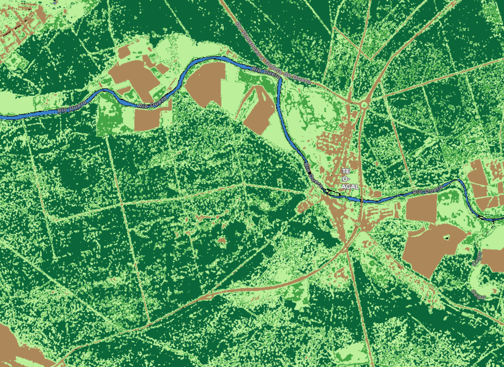
Image 2 shows Ribadesella, Asturias (Spain), a zone with dense forests by the sea. 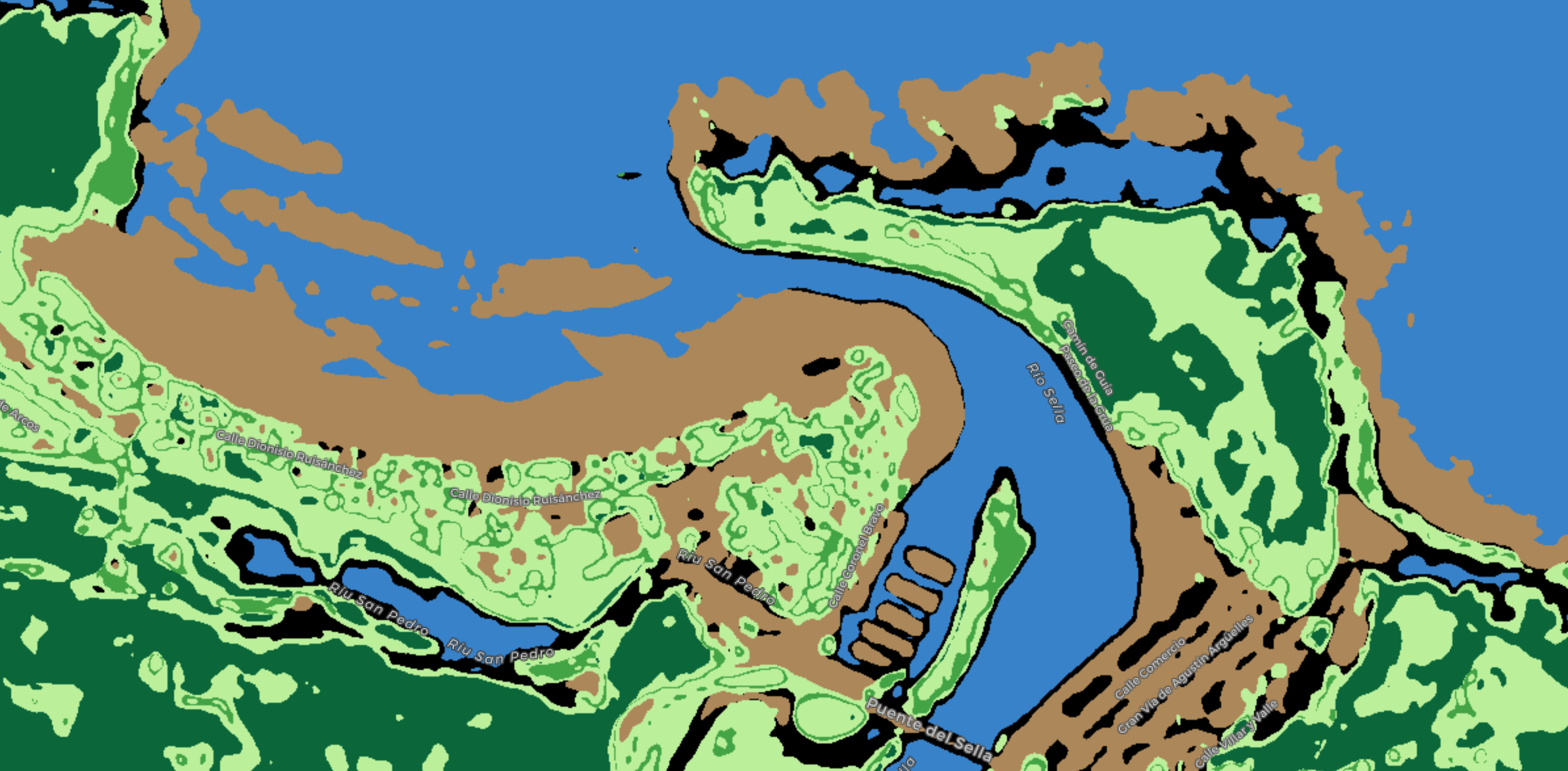
Image 3 shows a beautiful zone in New York. 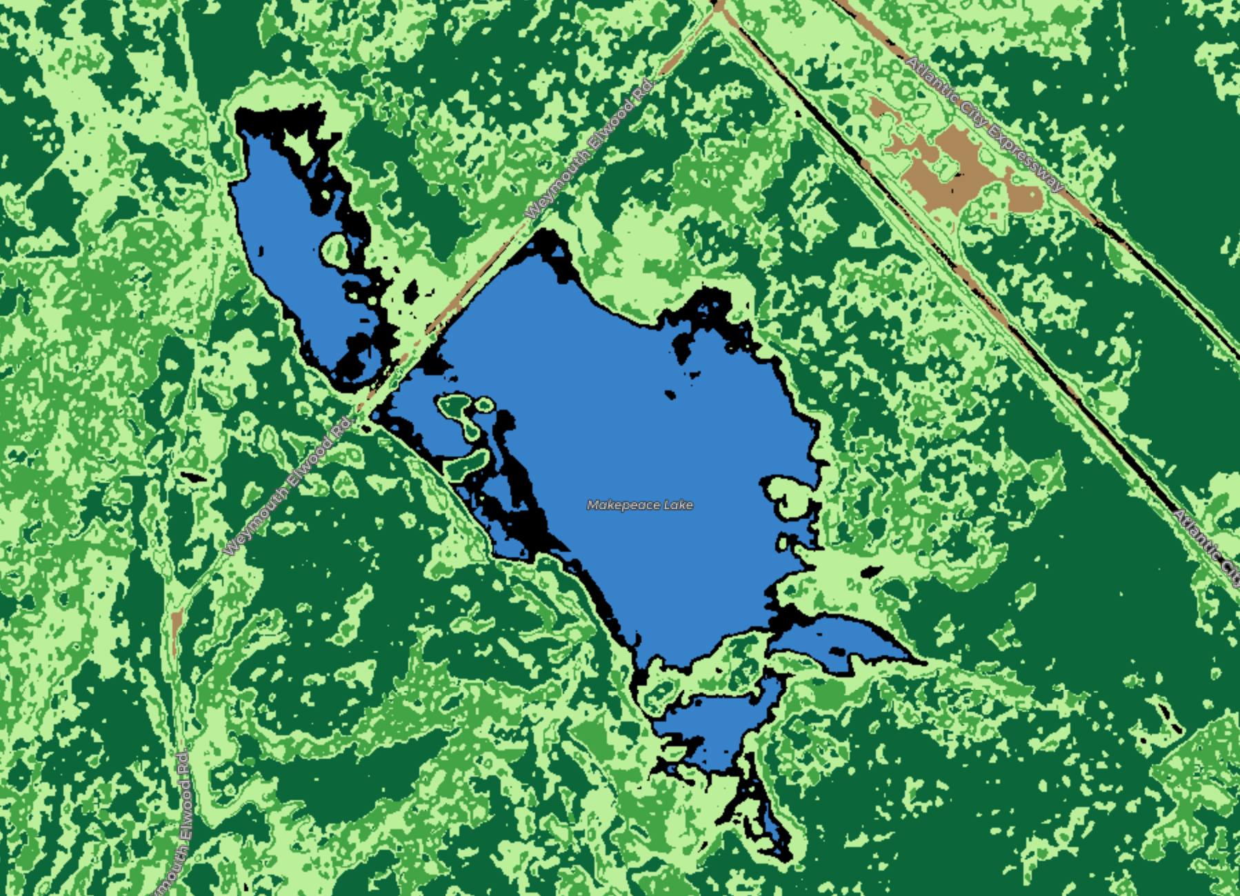
Image 4 shows a forest zone near a lake in Japan. 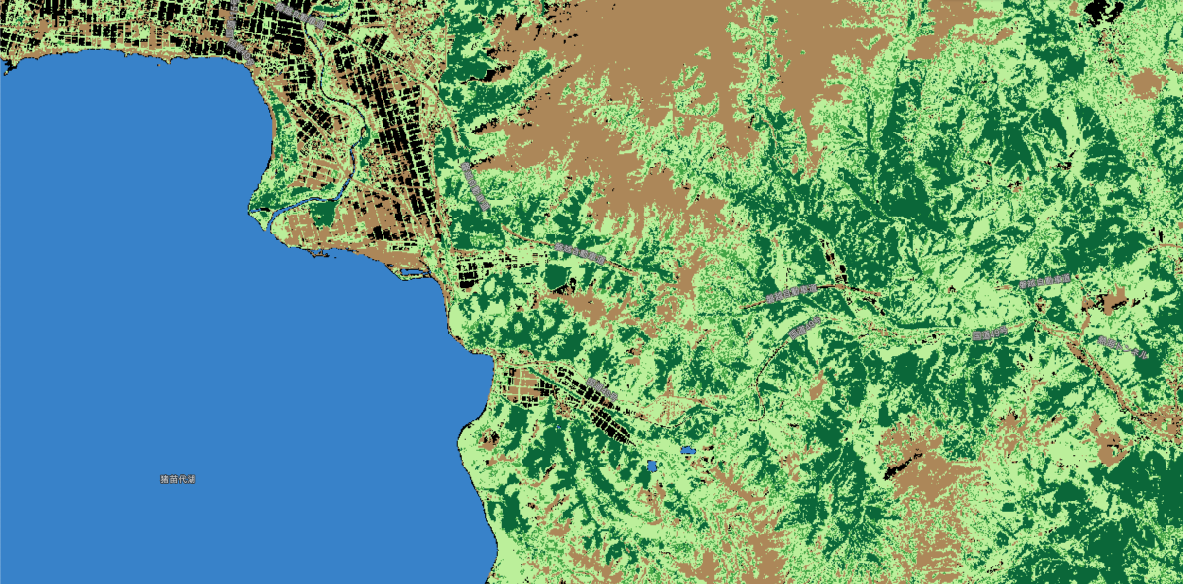
All of the images show the result of the script using the default parameters.
Credits
Azadeh ABDOLLAHNEJAD*, Dimitrios PANAGIOTIDIS, Peter SUROV›. “Forest canopy density assessment using different approaches ñ Review”. Journal of Forest Science, 63, 2017 (3): 106ñ115.