SAR for Deforestation Detection Script
//VERSION=3 (auto-converted from 1)
//
// SAR for deforestation detection
// ------------
// 2019 - Antonio Carlon Paredes
// License: CC BY 4.0
// https://creativecommons.org/licenses/by/4.0/
//
function setup() {
  return {
    input: [
      {
        bands: ["VV", "VH"],
      },
    ],
    output: { bands: 3 },
  };
}

const GAIN = 2.5;
const WATER_LIMIT = 0.1;
const FOREST_LIMIT = 0.2;
const INVERSE_FACTOR = 25;

const GREEN_GRADIENT = [
  [1.0, 0x80f300],
  [0.5, 0x406600],
  [0.0, 0x003300],
];

const RED_GRADIENT = [
  [1.0, 0xffffff],
  [0.525, 0xff8600],
  [0.3, 0xff6e00],
  [0.25, 0xae0000],
  [0.0, 0x000000],
];

const GREEN_VIZ = new ColorRampVisualizer(GREEN_GRADIENT, 0, 1);
const RED_VIZ = new ColorRampVisualizer(RED_GRADIENT, 0, 1);

const evaluatePixel = function (samples, scenes) {
  let vv = samples.VV;
  let vh = samples.VH;

  let area = vv * vh;
  let v_len = Math.sqrt(vv * vv + vh * vh);
  let v_angle_weighted = 0;
  if (vv > 0) {
    v_angle_weighted = Math.atan(vh / vv) / (Math.PI / 2);
  }
  let v_len_inverse = 0;
  if (v_len > 0) {
    v_len_inverse = 1 / (INVERSE_FACTOR * v_len);
  }

  if (v_len < WATER_LIMIT) {
    return [0];
  } else if (v_len > FOREST_LIMIT) {
    let index = GAIN * v_len - v_angle_weighted;
    return GREEN_VIZ.process(index);
  } else {
    let index = GAIN * v_len_inverse + v_angle_weighted;
    return RED_VIZ.process(index);
  }
};Evaluate and Visualize
General description of the script
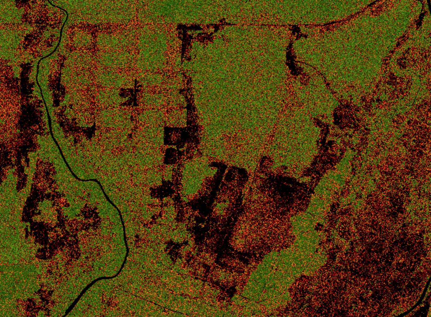
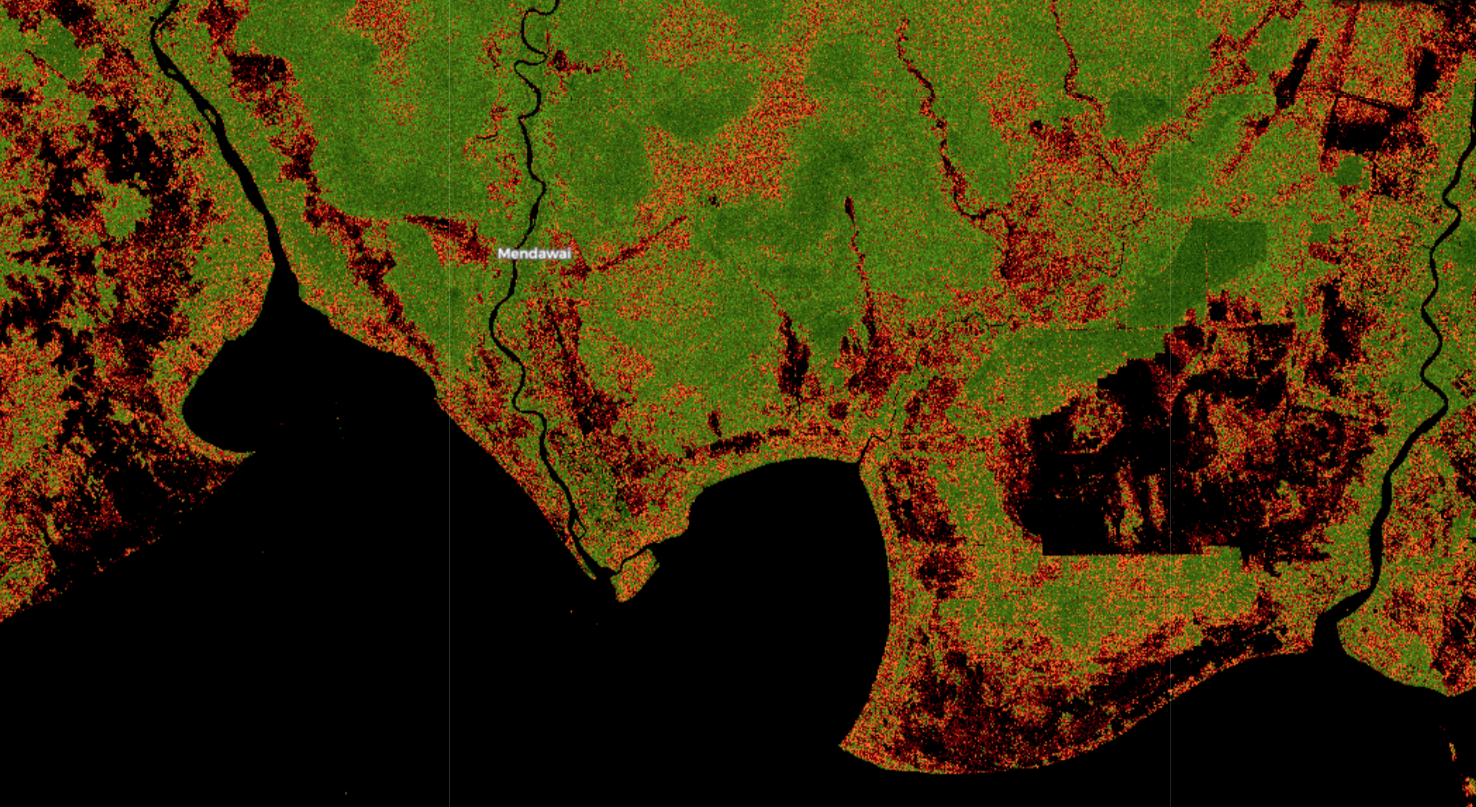
The script uses the VV and VH bands of the Sentinel-1 and transforms the cartesian space of VV and VH to polar coordinates computing the length and angle of the resulting vector and also the area of the square defined by VV and VH. Then it uses the length of the vector as a classifier to discriminate between water, forest and soil.
The script paints in black the water and bare soil areas, and uses both the length and the angle to draw a scale for the forest (green) and soil (red), drawing a stronger green where more forest has been classified and a stronger red or black where more soil has been found.
Details of the script
The script only uses the VV and VH bands of the Sentinel 1, so it will identify bare soil as water (black) and is intended to be used in forest area, returning strange results when used in populated areas.
Author of the script
Antonio Carlón Paredes
Description of representative images
The images show several zones of Borneo, in areas affected by palm oil deforestation.