Barren Soil Script
//VERSION=3 (auto-converted from 1)

//Author: Monja Sebela

function evaluatePixel(s) {
    let val = 2.5 * ((s.B11 + s.B04)-(s.B08 + s.B02))/((s.B11 + s.B04)+(s.B08 + s.B02));
    return [2.5* val, s.B08, s.B11];
}
function setup() {
  return {
    input: [{
      bands: [
          "B02",
          "B04",
          "B08",
          "B11",
          "B12"
      ]
    }],
    output: { bands: 3 }
  }
}
//VERSION=3
// Barren soil (Bare Soil Index) - Evalscript V3 multi-output update of the original
// single-output script by Monja Sebela. This "Updated version" created by András Zlinszky (Sinergise) and AI:
// * adds `index` and `eobrowserStats` outputs (the BSI scaled to 0..1) so EO Browser
// shows the value at a pixel and builds Statistical Info / temporal charts;
// * masks clouds, water (and other non-soil classes) via the Scene Classification
// Layer, using the same palette approach as the kNDVI script
// (https://custom-scripts.sentinel-hub.com/custom-scripts/sentinel-2/kndvi/);
// * keeps the original colour scheme for land pixels.
//
// BSI = ((B11 + B04) - (B08 + B02)) / ((B11 + B04) + (B08 + B02))
function setup() {
return {
input: ["B02", "B04", "B08", "B11", "SCL", "dataMask"],
output: [
{ id: "default", bands: 3 },
{ id: "index", bands: 1, sampleType: "FLOAT32" },
{ id: "eobrowserStats", bands: 1, sampleType: "FLOAT32" },
{ id: "dataMask", bands: 1 },
],
};
}
// SCL classes to mask out (recoloured, and excluded from the index): no-data, defective,
// shadows, water, clouds, cirrus and snow. Same palette as the kNDVI script.
const cloud_palette = {
0: [0, 0, 0], // No Data - black
1: [1, 0, 0.016], // Saturated / defective - red
2: [0.525, 0.525, 0.525], // Dark area / topographic shadows - dark grey
3: [0.467, 0.298, 0.043], // Cloud shadows - dark brown
6: [0, 0, 1], // Water - blue
7: [0.506, 0.506, 0.506], // Unclassified - grey
8: [0.753, 0.753, 0.753], // Cloud medium probability - grey
9: [0.949, 0.949, 0.949], // Cloud high probability - white
10: [0.733, 0.773, 0.925], // Thin cirrus - pale blue
11: [0.325, 1, 0.98], // Snow / ice - bright cyan
};
function evaluatePixel(s) {
let bsi = (s.B11 + s.B04 - (s.B08 + s.B02)) / (s.B11 + s.B04 + s.B08 + s.B02);
let val = 2.5 * bsi; // unscaled value that drives the original colour scheme
let masked = Object.keys(cloud_palette).includes(s.SCL.toString());
// Default visualization: original colours on land, palette colours on masked classes.
let color = masked ? cloud_palette[s.SCL] : [2.5 * val, s.B08, s.B11];
// Index scaled to [0, 1]: 1 = definitely bare soil, 0 = not bare soil at all.
// NaN on masked pixels so they are excluded from the index readout and statistics.
let index = masked ? NaN : Math.max(0, Math.min(1, val));
return {
default: color,
index: [index],
eobrowserStats: [index],
dataMask: [s.dataMask],
};
}Evaluate and Visualize
General description of the script
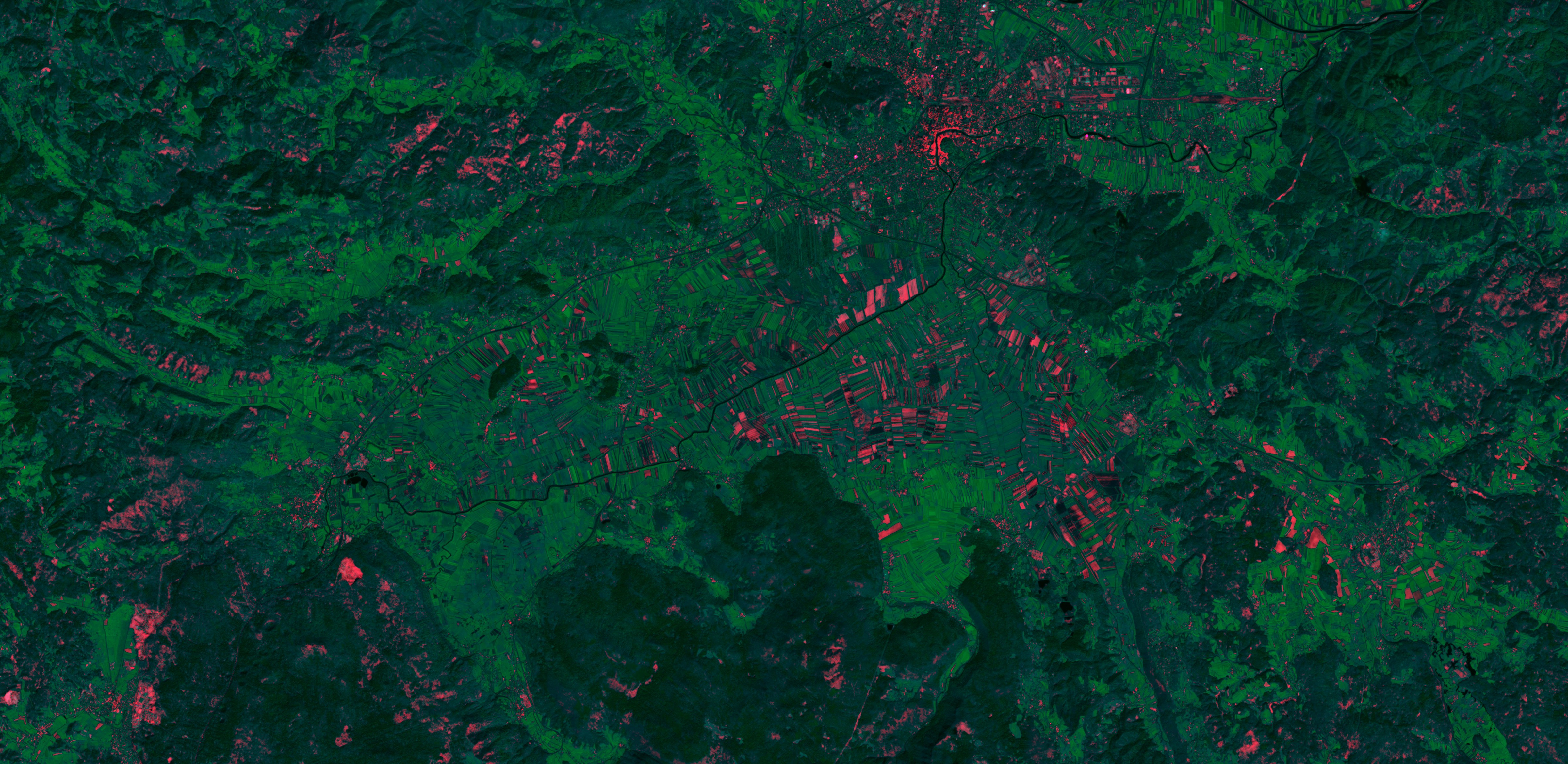
The barren soil script applies the Bare soil index (BSI) to the red channel, with NIR B08 applied to the green channel and SWIR band B11 applied to the blue channel. The index is multiplied to increase its brightness. It shows all vegetation in green and barren ground in red colors. Water appears black. As the script displays barren ground in red, the user can use this information to figure out the status of the crops (growing, not yet growing), detect recent deforestation or monitor droughts. It can also be used to detect landslides or determine the extent of erosion in non-vegetated areas. Unfortunately, it also highlights certain buildings, making bare ground areas difficult to separate from dwellings. It should be noted, that the result depends on season vegetation and farming.
The bare soil index for Sentinel-2:
BSI = ((B11 + B04) - (B08 + B02)) / ((B11 + B04) + (B08 + B02))
The Updated version tab (updated_script.js) is an Evalscript V3 rewrite that keeps the same colour scheme but adds two extra outputs - index and eobrowserStats (the BSI scaled to 0-1, where 1 = definitely bare soil and 0 = not bare soil) - so EO Browser shows the value at a pixel and can build Statistical Info and temporal charts. It also masks clouds and water (and other non-soil classes) via the Scene Classification Layer, following the same palette approach as the kNDVI script. Updated-version contributor: András Zlinszky.
Author of the script
Monja Sebela
Description of representative images
Barren Soil script applied to Sentinel-2 image south of Ljubljana, Slovenia.
Credits
The BSI used is the following one:
BSI = ((SWIR2 + R)−(NIR + B)) / ((SWIR2 + R)+(NIR + B))
It was found in this article, page 3:
- A Modified Bare Soil Index to Identify Bare Land Features during Agricultural Fallow-Period in Southeast Asia Using Landsat 8. Can Trong Nguyen, Amnat Chidthaisong, Phan Kieu Diem, Lian-Zhi Huo. Land 2021, 10, 231. Page 3. URL: https://www.mdpi.com/2073-445X/10/3/231/pdf