WorldCover Map visualisation script
//VERSION=3

// This custom script visualises WorldCover map

function setup() {
  return {
    input: ["Map", "dataMask"],
    output: {
      bands: 4,
      sampleType: "AUTO"
    }
  }
}

const map = [
    [10, 0x006400], // Tree cover
    [20, 0xffbb22], // Shrubland
    [30, 0xffff4c], // Grassland
    [40, 0xf096ff], // Cropland
    [50, 0xfa0000], // Built up
    [60, 0xb4b4b4], // Bare / sparse vegetation
    [70, 0xf0f0f0], //	Snow and Ice
    [80, 0x0064c8], //	Permanent water bodies
    [90, 0x0096a0], //	Herbaceous wetland
    [95, 0x00cf75], //	Mangroves
    [100, 0xfae6a0], //	Moss and lichen

  ];

const visualizer = new ColorMapVisualizer(map);

function evaluatePixel(sample) {
  return [visualizer.process(sample.Map)[0], visualizer.process(sample.Map)[1], visualizer.process(sample.Map)[2], sample.dataMask];
}General description of the script
This script visualises WorldCover Map
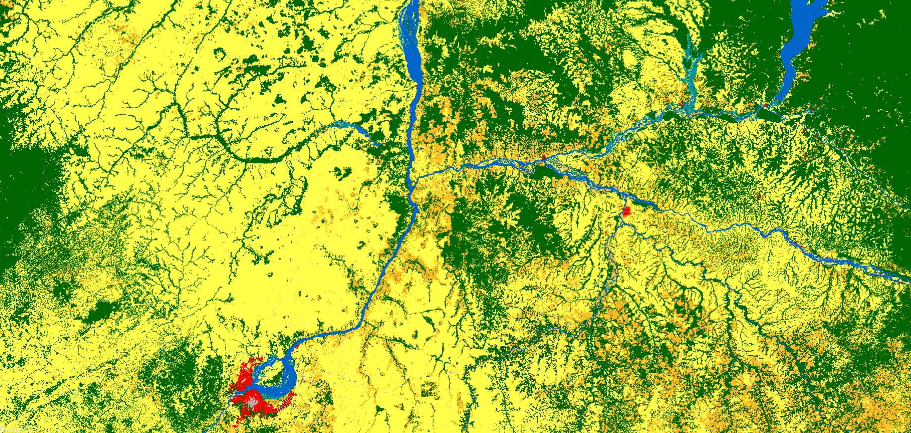
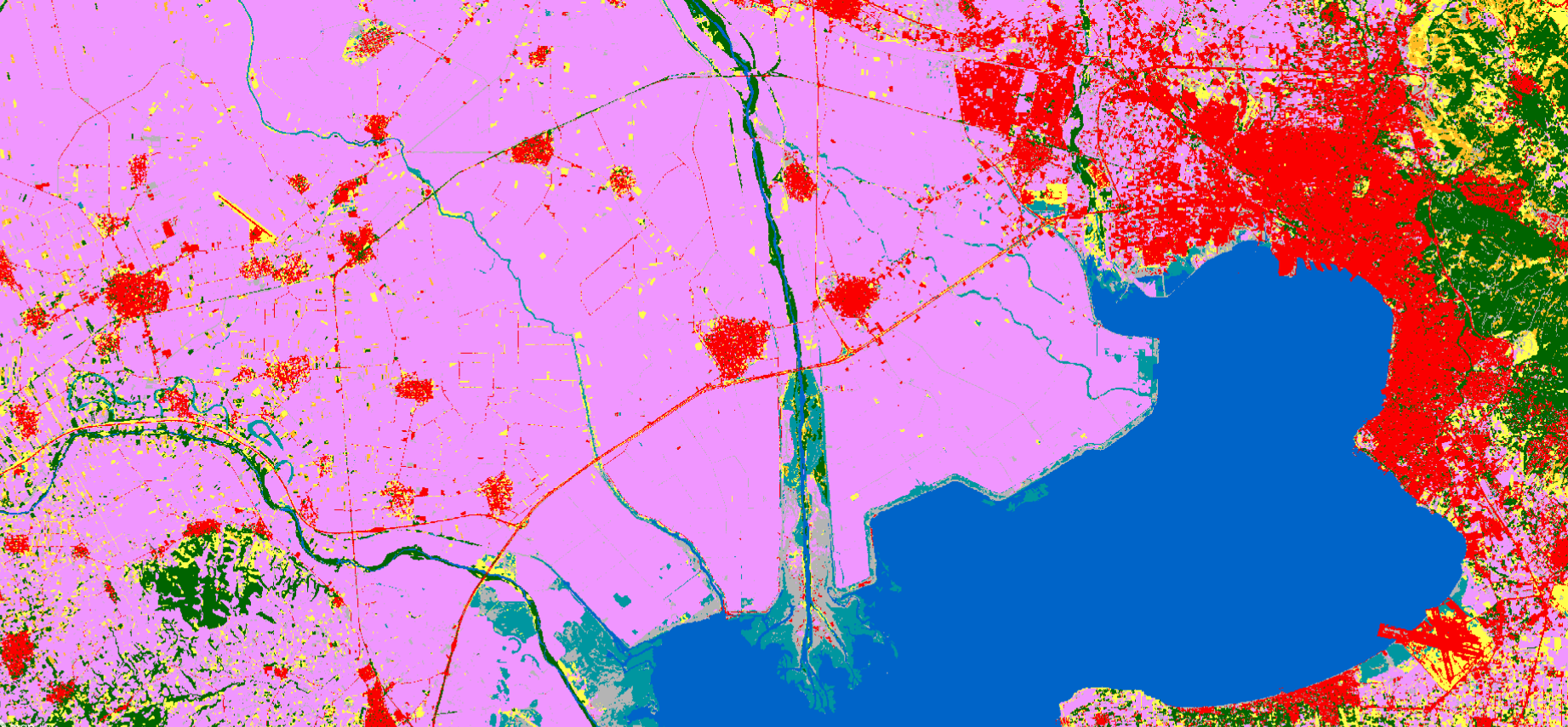
Table 1: Color legend for WorldCover classification map
| Value | Color | Color Code | Class Name |
|---|---|---|---|
| 10 | 0x006400 | Tree cover | |
| 20 | 0xffbb22 | Shrubland | |
| 30 | 0xffff4c | Grassland | |
| 40 | 0xf096ff | Cropland | |
| 50 | 0xfa0000 | Built up | |
| 60 | 0xb4b4b4 | Bare /sparse vegetation | |
| 70 | 0xf0f0f0 | Snow and Ice | |
| 80 | 0x0064c8 | Permanent water bodies | |
| 90 | 0x0096a0 | Herbaceous wetland | |
| 95 | 0x00cf75 | Mangroves | |
| 100 | 0xfae6a0 | Moss and lichen | |
| 0 | No data |
Description of representative images
WorldCover 2020, Thessaloniki, Greece visualised in EO Browser
WorldCover 2020, Kinshasa, Democratic Republic of Congo visualised in EO Browser